
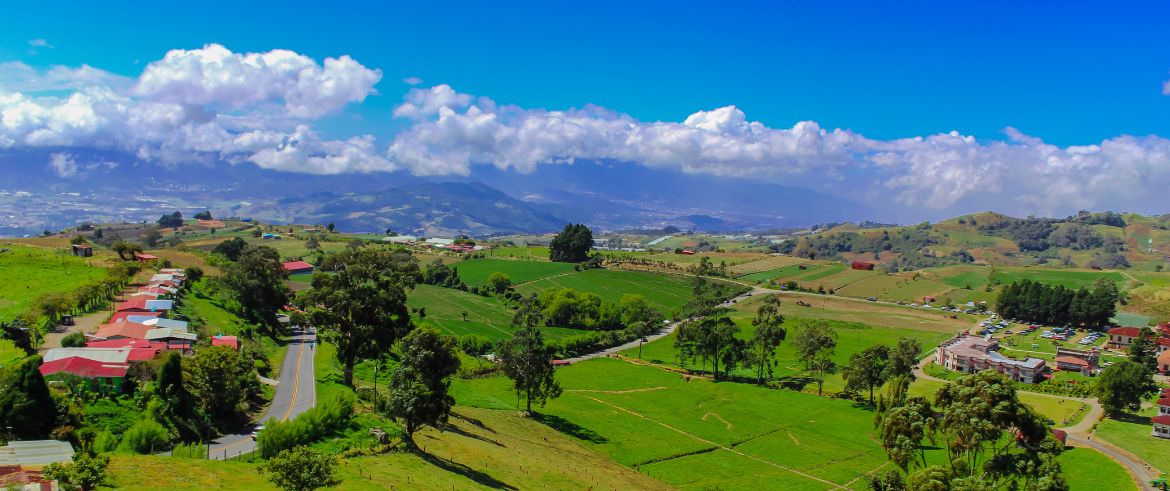
Most people who land in Costa Rica drive straight past Cartago. The highway from San José points toward the beaches and the volcano resorts of La Fortuna, and the old colonial capital sits just 25 kilometres east of the airport, quietly doing its own thing at 1,400 metres above sea level. That is precisely why it works so well for travelers who prefer small farms, cloud forest and slow mornings over crowded tour buses. Cartago province holds two national parks, the most visited pilgrimage site in Central America, a botanical garden with more than a thousand orchid species, and a valley where coffee is still picked by hand on the slopes.
Rather than rushing from one attraction to the next, spend two or three days exploring the region’s agricultural landscapes, small villages and protected natural areas. Along the way, make time for local food, independent producers and the people who keep these places alive.
Why Cartago is the eco-traveler’s version of the Central Valley
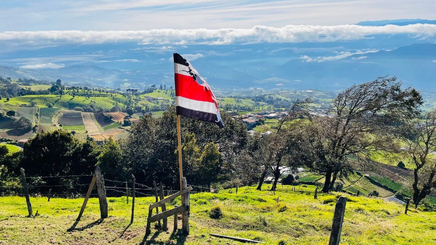
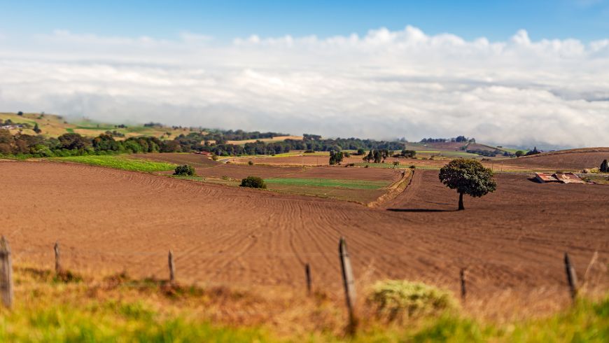
Cartago was Costa Rica’s capital from 1563 until 1823, when the government moved to San José after a short civil war. Earthquakes in 1841 and 1910 flattened much of the colonial architecture, so what remains is less about buildings and more about landscape. The province climbs from the Reventazón river basin up to the crater of Irazú at 3,432 metres, and that altitude range packs several ecosystems into a single day’s drive: coffee and sugarcane in the lowlands, dairy pasture and vegetable farms on the volcano’s flanks, and páramo and cloud forest at the top.
The region also has a strong tradition of small-scale agriculture. The villages of Cot, Tierra Blanca and Pacayas supply a large share of the country’s potatoes, onions and carrots, and many of the farms sell directly to visitors. For anyone who tries to keep their travel footprint low, this is a place where buying local is the default rather than a marketing line.
Cartago is also a good reminder that a place’s appeal goes beyond its best-known attractions. Its agricultural traditions, landscapes and everyday community life are part of what makes the region worth exploring.
Day one: the Basilica, the ruins and Irazú before the clouds roll in
Start early. The Basílica de Nuestra Señora de los Ángeles is open from dawn, and seeing it before the parking lots fill gives you the building almost to yourself. Every August 2nd, more than a million pilgrims walk here from across the country to visit La Negrita, a small dark stone figure of the Virgin found in 1635. Outside of that date, the Byzantine-style church is calm, and the spring behind it, where locals fill bottles with water they consider blessed, is a nice detail that most guidebooks skip.
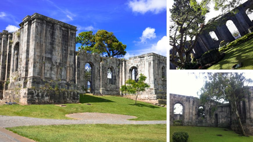
Six blocks west are Las Ruinas, the shell of the Santiago Apóstol parish church that was never completed after the 1910 earthquake. Today it is a small garden inside stone walls, and a good place to sit with a coffee from one of the cafés on the plaza.
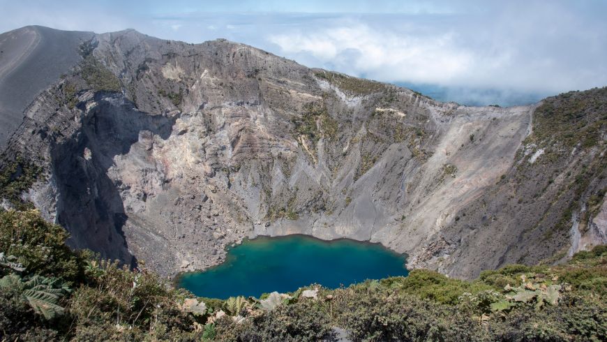
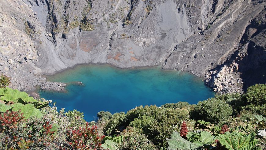
Then head up to Irazú. The road from Cartago climbs 30 kilometres through farmland and takes about 50 minutes. The crater lookout at the top opens at 8 a.m. and the general rule is that whatever you see before 10 is what you get; after that, clouds pour over the rim from the Caribbean side and the view disappears. On a clear morning the main crater shows a pale green lake, and from the Diego de la Haya lookout you can sometimes see both the Pacific and the Caribbean at once. Bring a jacket. It is often around 8 degrees Celsius at the top, even when Cartago town is sunny.
On the way down, the farms along Route 219 sell strawberries, cheese and apples from roadside stands. The dairy at Finca Don Pepe near Cot does a short walk through their pasture if you call ahead. If you stop at a farm or roadside stall, ask about the products in season and how they are grown. Buying directly from local producers can make a small but meaningful contribution to the rural economy.
Day two: the Orosi Valley loop
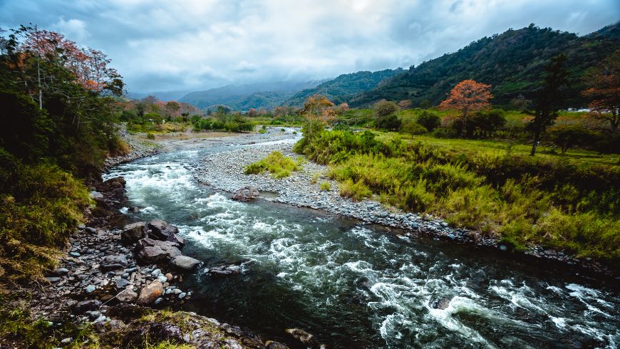
The Orosi Valley is a 40-kilometre loop that starts and ends in Paraíso, about 8 kilometres from Cartago, and it is the kind of drive where you stop every ten minutes. Go clockwise.
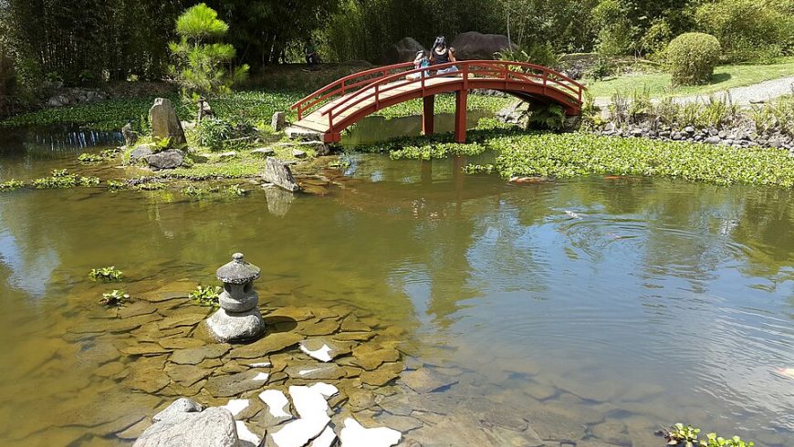
The first stop is Jardín Botánico Lankester, run by the University of Costa Rica. It holds one of the largest orchid collections in the Americas, and the Japanese garden and bromeliad section are worth an hour even if you cannot tell a Cattleya from a Masdevallia. The garden also contributes to botanical research and orchid conservation. Check its current opening hours and admission arrangements before visiting.
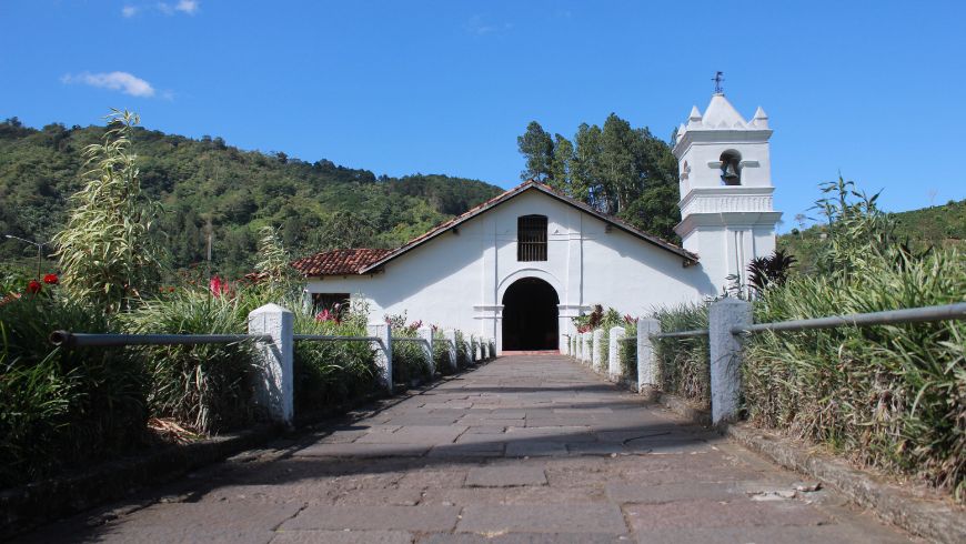
Continue to the Mirador de Orosi, a public park on a ridge with a view down the whole valley. From there the road drops into Orosi village, where the Iglesia de San José de Orosi, built in 1743, is the oldest church in Costa Rica still in use. The small museum next door holds colonial religious art and farm tools.
Just past the village, the Tapantí National Park entrance is at the end of a gravel road along the Río Grande de Orosi. Tapantí receives some of the heaviest rainfall in the country, close to 7,000 millimetres a year in parts, and the forest shows it: moss on everything, waterfalls off the cliffs, and a bird list that includes quetzals in the upper sections. The Oropéndola trail is an easy 1.2 kilometres to a swimming spot in the river. Bring a rain jacket regardless of the forecast.
Follow the trails open to visitors and check the park’s current trail information before setting out. The rainforest can be wet even when the surrounding valley is sunny, so bring a waterproof jacket and suitable footwear. Stay on marked paths, take all your rubbish with you and observe wildlife without disturbing it.
Back on the loop, cross the dam at Cachí and stop at Casa del Soñador, a wooden house carved by the sculptor Macedonio Quesada and now run by his sons, who still carve coffee-wood figures on the porch. A few minutes later are the ruins of Ujarrás, a church from the 1690s abandoned after floods in 1833, sitting in a mown lawn surrounded by sugarcane. The road then climbs back to Paraíso past coffee farms, several of which, like Finca Cristina, run organic and shade-grown operations that you can visit.
Getting around and exploring responsibly
Public transport options in the region are limited, especially if you want to explore beyond the main towns. Buses connect Cartago with Orosi and the Irazú area, but reaching the crater, visiting Tapantí National Park and exploring the valley’s rural roads can require additional planning. If you want to visit several places in two or three days, renting a car can offer greater flexibility. The roads in the valley are mostly paved, although some sections may be rougher, particularly during the rainy season. If you arrive at Juan Santamaría Airport, you can also look into car rental in Cartago, Costa Rica, with pickup in the city itself, rather than driving through San José immediately after landing.
To reduce the environmental impact of your journey, consider choosing an electric or hybrid car, depending on availability and your itinerary. Distances are relatively short, and a compact vehicle should be sufficient for most routes. If you opt for an electric car, check charging points along your route and at your accommodation before setting off. Whenever possible, combine nearby attractions into a single trip or share the journey with other travellers to reduce unnecessary driving.
Where to stay and eat

Orosi village has several family-run lodges along the river. Orosi Lodge, run by a German-Costa Rican couple, has a handful of rooms, a bakery and bicycles for guests, and sources most of its breakfast from the valley. In Cartago town itself, options are more limited, but the Hotel Rio Perlas in Orosi has thermal pools fed by hot springs, which feels earned after a cold morning on Irazú.
When choosing where to stay, look beyond the location and consider the practices declared by each accommodation: local sourcing, energy and water management, waste reduction and the relationship with the surrounding community. Contact the property directly if you would like to know more about its environmental initiatives.
If you are planning a wider trip through the country, you can also explore eco-friendly accommodation in Costa Rica on Ecobnb, and discover places that offer different ways to experience the country and its landscapes.
For food, the sodas (small family restaurants) around Cartago’s central market serve the dish the city is known for: chorreadas, thick sweet corn pancakes, usually with sour cream and coffee. The Thursday and Saturday farmers’ market at the Plaza de la Independencia is the best place to see what the volcano’s farms actually grow.
Eating at small, locally run restaurants and buying seasonal products are also ways to discover regional food traditions while supporting businesses rooted in the community.
Timing and a few practical details
The dry season from December to April gives the best odds of a clear Irazú, but the valley is green and the waterfalls at Tapantí are strongest in the wet months. September and October are the rainiest, and the Caribbean-side clouds reach Cartago earlier in the day. Whatever the season, check the forecast and park conditions before leaving, and be prepared to adjust your plans if the weather changes.
Both Irazú and Tapantí have official opening hours, admission fees and booking procedures that may change. Check the official SINAC website for Irazú and the official SINAC website for Tapantí for current information before your visit. Mobile reception may be limited inside protected areas and in parts of the valley, so downloading maps for offline use is a sensible precaution.
If you have only a couple of days in Cartago province, leave room in your itinerary for unplanned stops: a roadside fruit stall, a conversation with a local producer or a quiet walk through the valley. These small encounters can reveal a side of Costa Rica that goes beyond its famous volcanoes and beaches.
Cover image: photo via Canva PRO


