Amazing Rysy- Hike Slovak- Polish borders!
-
Why we love it
For its breathtaking nature - Travelling time: 9 h
- Difficulty: Hard
- Length: 10 km
- Total Elevation Gain: 1086 m
- Way to travel: by foot
- Cost: 0 €
- Our Advice: Choose the stable weather. September and October are the best months for hiking. Good idea is to start in the early morning.
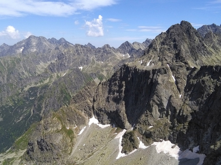
With its 2499m, Rysy is the highest mountain of Poland. Under the Hilltop, Chalet Rysy is the highest located Chalet in High Tatras (2250m). Moreover, Rysy is a real natural treasure of both countries. Yearly, thousands of tourists visit this hike to experience unforgettable hike through 2 countries in once.
How to get there:
By tram: from Popradske pleso station.
By car: Park your car in Strbske pleso parking lot.
The hike:
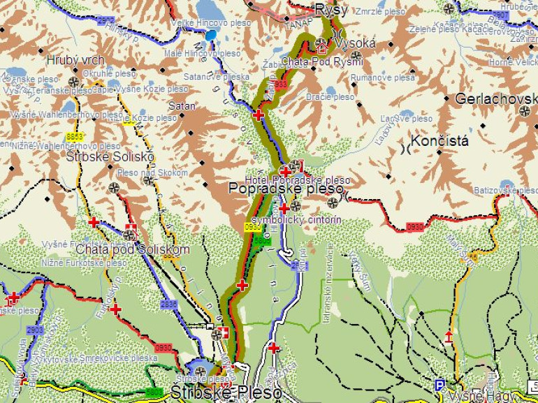
From the hotel Patria near Strbske pleso, follow the red tourist marker to Tatranska Magistrala. You will pass the stream Mlynica. Here, you begin to ascent all the way to Trigan.
From Trigan, continue to crossroad “zimna cesta” (winter path) and follow red marker. The hike continues through forest, however, after a while there is open space on hillside Patrie to the bridge over Hincov steam. In a short while, you will reach the crossroad over Popradske pleso.
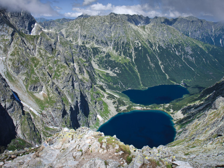
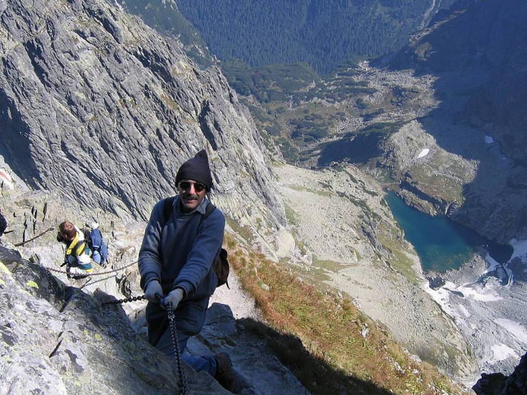
From there, go to Chalet Popradske pleso. You can take a break and buy something to eat. From Chalet, continue up to Mengusovska dolina. When you come to the crossroad Zabi potok, turn right and follow the steep stony path. You will pass great rock called Hincova skala. Go through the bridge over Zabi potok. Here you will start to steep out by many serpentines on the slope to striking rock called Wachterka. You will enter “kotlina Zabich plies”. The hiking trail lead over the Velke Zabie Pleso. On the right, you will start to rise short, but steep twists in the rubble below the rock wall. You will cross the wall thanks to the chains, which are turning right. These chains are straightening up on the way to waterfall.
From here, we continue through the valley below Váh through the steep slopes along the rocky sidewalk to Chalet Rysy. From the chalet follow serpentines to the saddle of Vah. From the saddle, continue left to the southwest ridge of Rysy. In the bends go slightly up to the rib. Several meters down, we pass under the southeast and the main hilltops. Finally, through the sharp serpentines, we head out to the northwest - the viewing peak of Rysy.
You can choose if you want to hike back from Rysy to Poland or Slovakia. Polish hike is quite hard, especially for your knees. If you choose the Slovak one, you will follow the same way as you were hiking to Rysy.
Interesting Facts:
• Rysy are named based on polish word “Rysa”, what mean a line. The reason is a distinctive, long-term snowy gutter below the top, visible from the Polish side.
• Rysy has 3 hilltops. The highest one is in the middle (2503m), then the northwest (2499.6 m) and the third highest point is southeast.
• The northwest hilltop is the highest mountain of Poland
• In 1913, communist leader V.I. Lenin hiked Rysy from Polish side.
Virtual tour:
Author: Nikola Meciarova
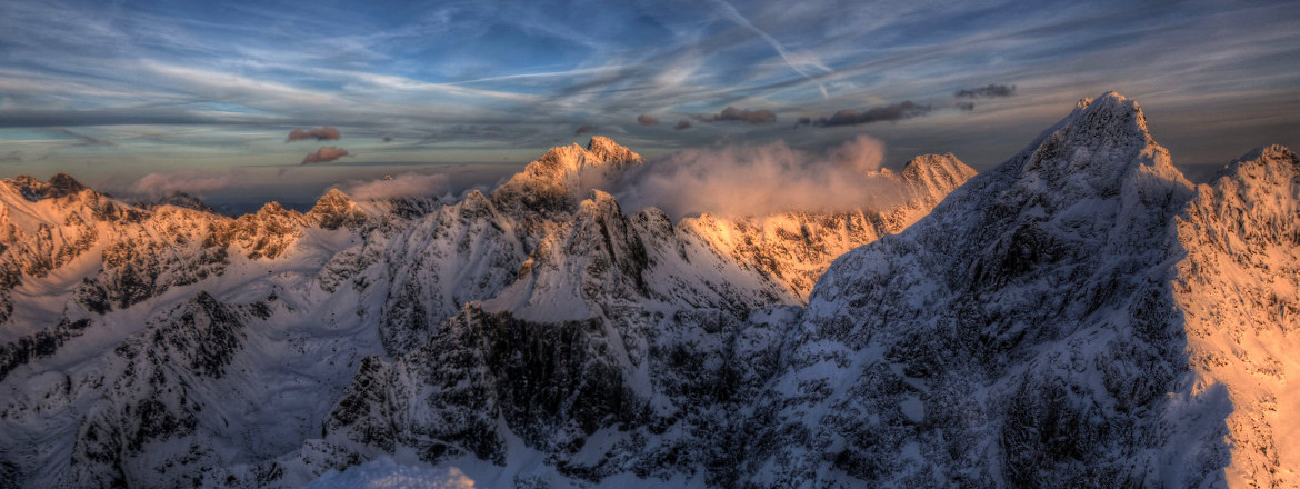
Cover Photo: Photo by Maciej Kraus via Flickr