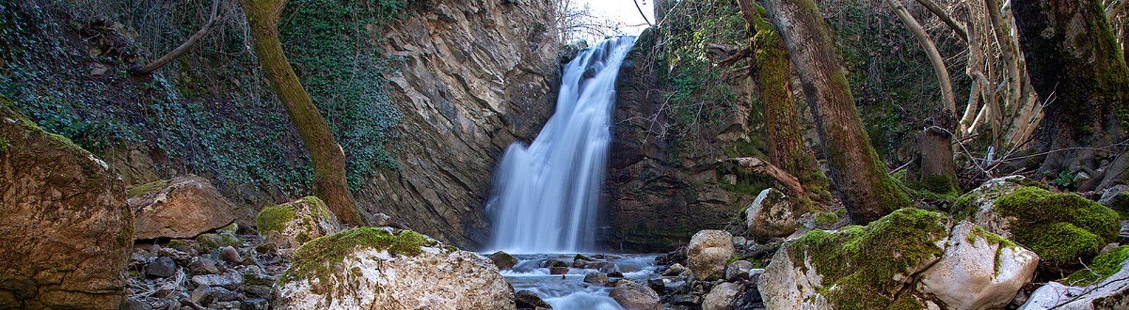
Waterfalls of San Fele
-
Why we love it
Path in a forest - Travelling time: 6 hours and 40 minutes
- Difficulty: Easy
- Length: 8 km
- Total Elevation Gain: 100 m
- Way to travel: On foot
- Cost: 0 €
- Our Advice: To go wearing rain gear and hiking shoes appropriate to the river context
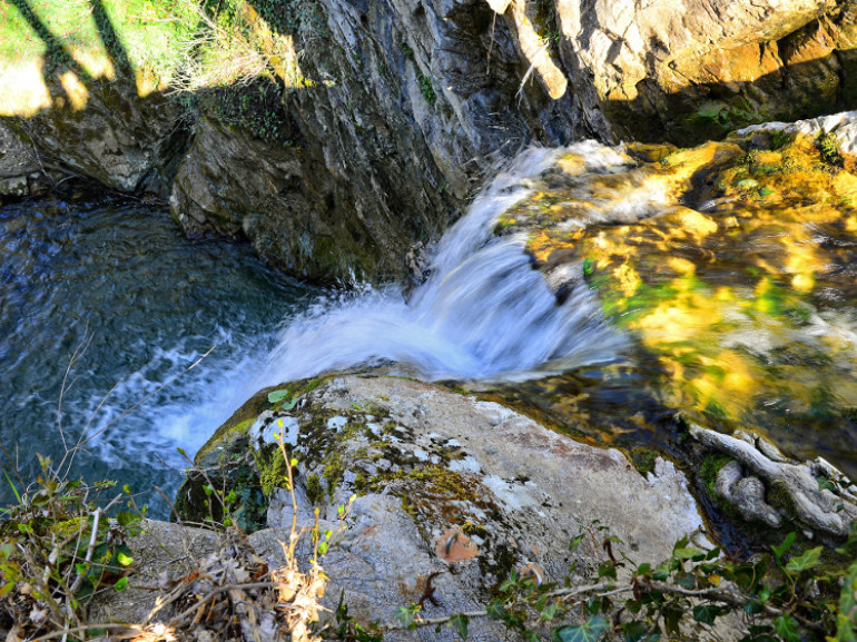
San Fele is an Italian town in the province of Potenza, in the north-western part of Basilicata. From the heights of the village flows the Bradano river, which cross the territory, making the details various heights, giving origin to the many features and Waterfalls of San Fele.
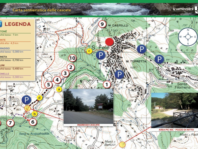
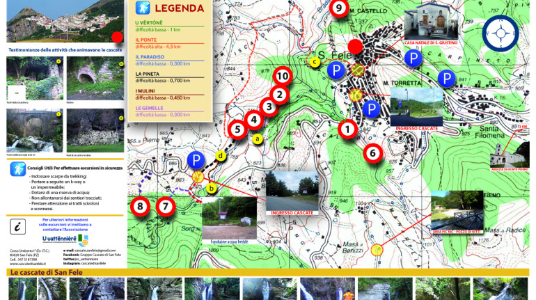
The total route is made up of about 8 km, divided as follows:

Path "La Pineta"
Main access route 700 m long to go in about 20 min.
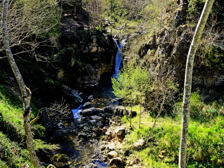
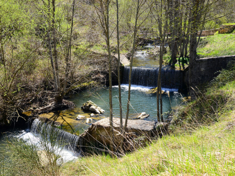
The path follows the Bradano river, in which are clearly visible in concrete dams and gabion stone: hydraulic works, made between the 50s and 60s to mitigate the erosive force of the water. There are the ruins of an ancient mill ( "D" word on the map).
"U Urtone" path
Path: 1 km to go in about 1 h
It is one of two locations that have access from the town of San Fele to reach the falls. (Visible Waterfallas: No. 1, 4 and 5 on the map)
Path "Il Paradiso"
Path: 300 m to go in about 10 min.
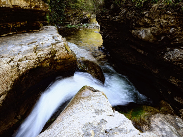
The special feature of this place is represented by the roar of the absolute silence surrounding and slow water. In summer the waterfall is reduced to a deep well more than 6 m.(Visible Waterfalls: n. 8 on the map)
"Il Ponte" path
Location: 4,5 km to go in about 4 h
It is one of two paths that have access directly from the town of San Fele: the path you take from Piazza Nocicchio. Suitable for those who practice hiking, used to walking. Characteristic of this process is the passage of a bridge built in the '20s - (c. On the map), which was for years a "fast" connection between the mountain and the village. Visible Waterfalls: n. 4 and 5 (on the map)
"Le Gemelle" path
Path: 300m to go in about 10 min
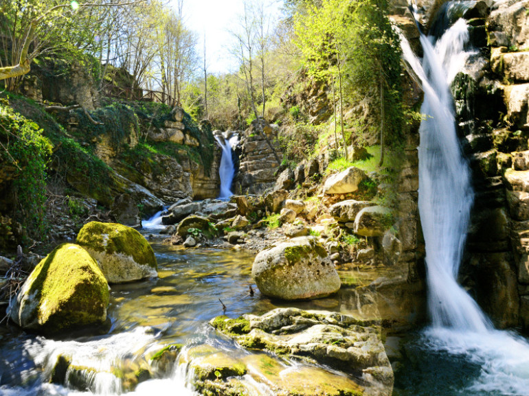
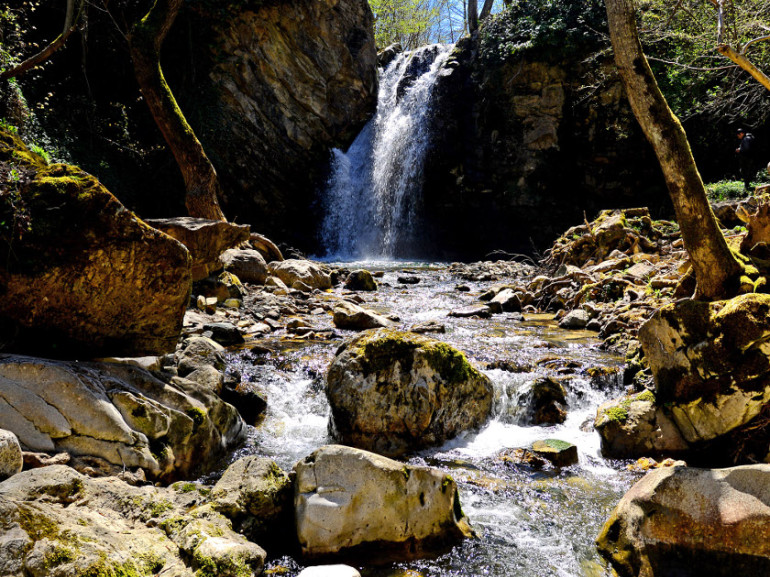
The path leads to one of the most picturesque waterfalls, "The twins". The waterfall was so renamed since it represents the meeting point of two waterfalls, originating respectively from the Bradano and Acquafredda's creeks, who confuse their own waters in a delicious laghetto. Visible Waterfalls: n. 7 (on the map)
"Fosso d'Anna" path
Path: 1 km to go in about 1 h
It is accessed by a path in the woods near the bridge Bradano Visible Waterfalls: n. 9 (map)
The falls are named "U Uattënnierë" transposition dialect of "fulling mill" machine used in old factories built near the falls to make the driving force of the water falling on a big wheel transmitted the movement of heavy hammers (or fulling). These, in and out of a bath (which were placed on the bottom tissues), served to beat the wool; properties feltranti cloth were thus made more compact and less rough.
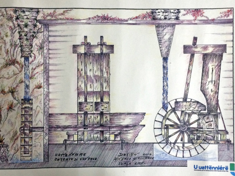
The fulling mill of San Fele remained in use until the 40s of the last century.
The power of the water was used for the operation of the old mills, the remains of which (such as those of Gualchiera) testify to the ingenuity and dedication to the work of Sanfelesi.
The route can also be considered an eco-stay as it is completely immersed in the green, you can enjoy a precious silence and is ideal to relax and unwind from the madding crowd.

Authoress: Federica Massaro
Contest "Share your green adventure"
Cover photo: ph. by Giacomo d'Elia, via flickr