Via Francigena from San Quirico to Radicofani
-
Why we love it
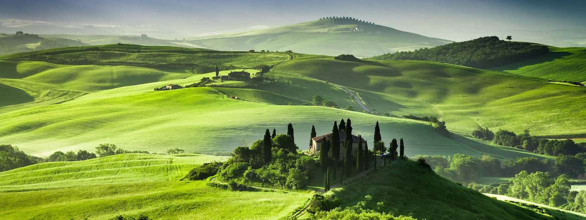
Because the landscapes that surround us along the way are breath-taking, such as the views of the Val d'Orcia and its very famous cypress - Travelling time: 8 hours
- Difficulty: Hard
- Length: 33 km
- Total Elevation Gain: 908 m
- Way to travel: by foot
- Cost: 0 €
- Our Advice: In San Quirico you must visit the Horti Leonini, perfect example of Italian garden. Lose yourself in its beauty and the geometry of the hedges.

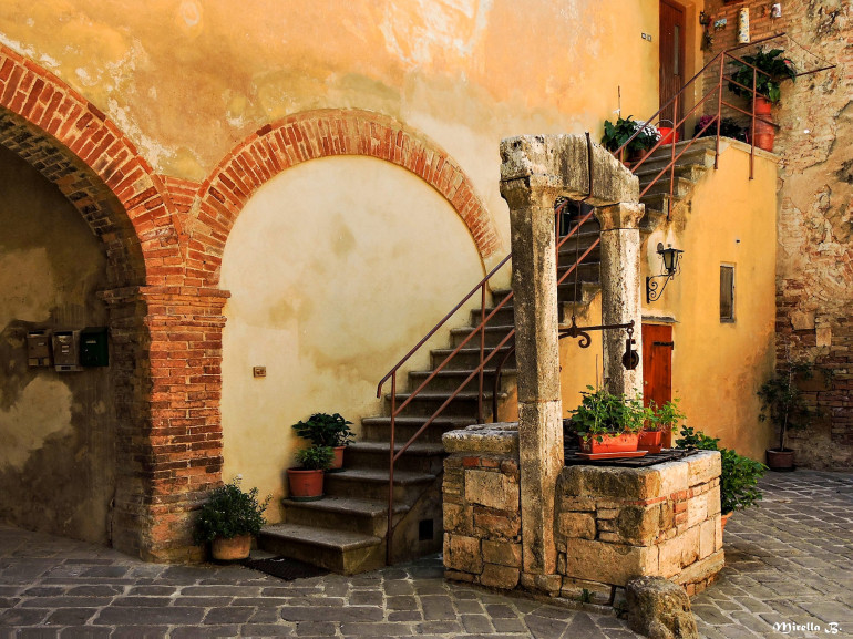
In San Quirico d’Orcia, a route of the Via Francigena, the famous pilgrimage road that starts in Canterbury and arrives in Rome, begins. We are in the heart of Val d'Orcia, in the province of Siena, at 424m above sea level. San Quirico d'Orcia is a village of Etruscan origin, surrounded by hills, vineyards and woods. The village is made of castles and medieval churches, picturesque narrow streets and stone fountains. Because of its elevated position, it’s one of the best spots to see the beautiful landscapes of the Valdorcia (the surrounding valley). For those who decide to stay in this delightful Tuscan village, here you can find all the best and closest eco-friendly accommodations.
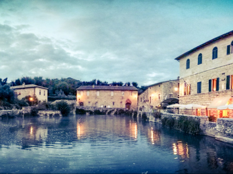
From the town we climb down towards a popular village, Bath Vignoni, known for its large thermal pool located in the central square. The old village is one of the most suggestive places in Tuscany and the thermal water were used already in Roman times.
After two hours of walking, up and down the sweet hills and crossing the river Orcia, we reach Gallina where we find the first food court of the itinerary. Here the routes become more and more challenging, but the pilgrims are rewarded with wonderful views of the Mount Amiata.

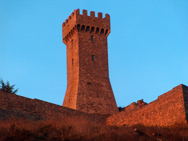
Beyond the Formone river we walk along the woods, in the difficult climb that leads us to Radicofani, our destination. An Ancient fortress, Radicofani has controlled for centuries the border between the Grand Duchy of Tuscany and the Papal States. We are at 800m above sea level and the view that the village offers is spectacular: the village overlooks the Val d'Orcia, the Amiata, the Apennines and we can also glimpse the lakes of Trasimeno and Bolsena, reachable in short time. The symbol of the village is its Rocca (castle) that have stand out for a thousand years. The castle has a troubled history, but it is strongly linked to the personality of Ghino di Tacco, the bandit with the manner of a gentleman named in Boccaccio's Decameron and in the Divine Comedy.
A demanding tour that rewards us with the emotions before the natural spectacles of the beautiful Tuscany.
Cover image: Landscape of Valdorcia, photo by Yosika ( happyholiday.travel ) via Flickr
Author: Chiara Marras