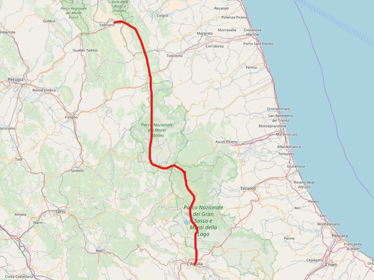
From Fabriano to L'Aquila along the "Terre Mutate" route
-
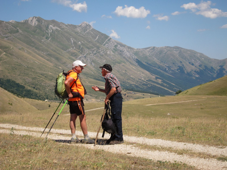
Why we love it
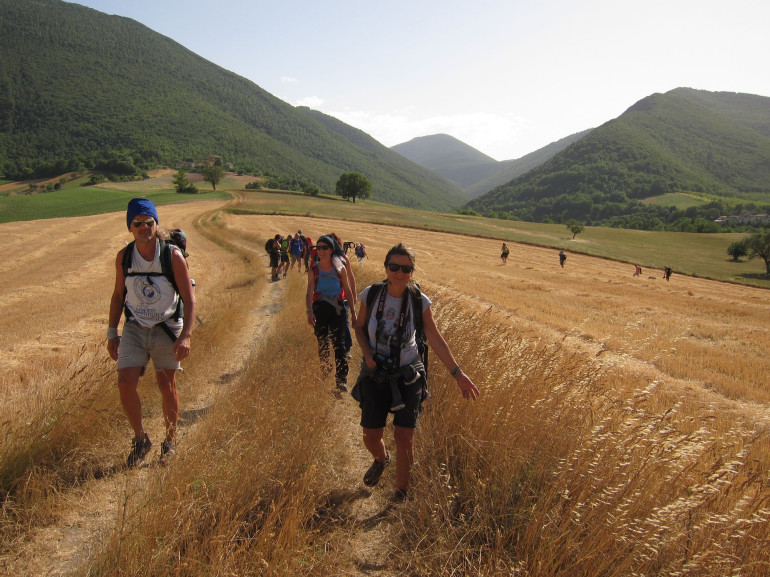
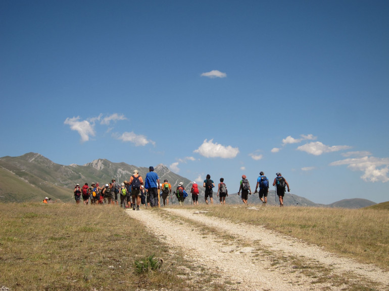
This is not merely an itinerary. It is a path to self-discovery, and a way to get to know the lands that are now facing the consequences of natural events. - Travelling time: The itinerary is divided into 14 stops, so at least 2 weeks are required
- Difficulty: Medium
- Length: 200 km
- Total Elevation Gain: 0 m
- Way to travel: On foot or by bike
- Cost: 0 €
- Our Advice: Explore the cities you stop into and let the locals tell you their stories.
An intense and touchin itinerary from Fabriano to L'Aquila, central Italy, to discover the Terre Mutate route (the transformed lands). Over 200km and 2 weeks of stories to discover among natural beauties and cities.
1. Fabriano - Matelica
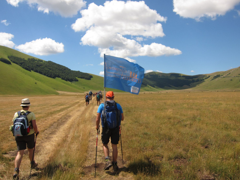
A journey going through the Monti Sibillini and Gran Sasso National Parks, to live the lands shaken by the hearthquakes in central Italy of the past years. These are lands that changed, so loved by their inhabitants that they were able to rise again. To get to know them and their stories, the "Terre Mutate" route was born. This is not merely a route, but a journey of over 200km supported by many local associations. Through the regions Marche, Umbria, Lazio and Abruzzo, to get to know these lands' rebirth in person.
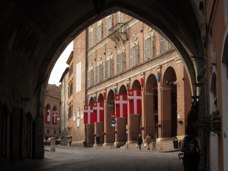
The first stage of this Route begins at the feet of the Appennines in the Region Marche, from the historical city center of Fabriano. The itinerary alternates paved and unpaved tracks, running along Monte Fano and Monte Alto, until you reach Matelica's city center. Overall, 25.5 km with a 6 hours walk.
Do not miss: Saint Silvester hermitage, Esanatoglia hamlet
2. Matelica - Camerino
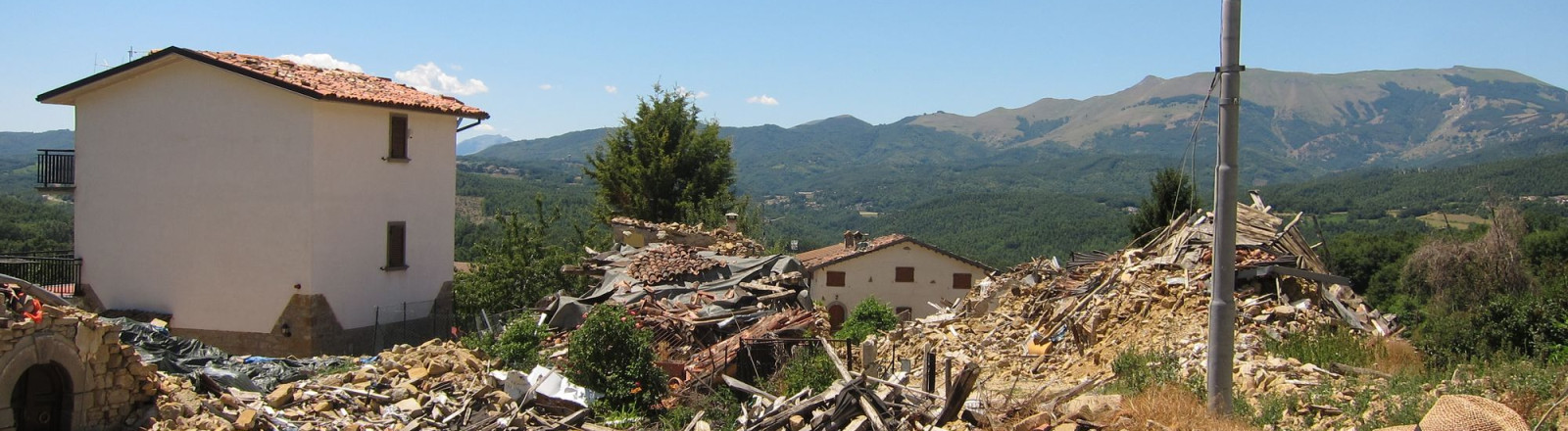
The second stage starts from Matelica and keeps going at quite a high altitude on Monte Pulischio, crossing different villages (Castel Sant'Angelo and Costa) to reach Camerino, destroyd by the hearthquake in 2016. 6 hours and a half today as well, with a 23.4 km length.
Do not miss: the enchanting Pioraco hamlet
Are you looking for a green hospitality once reached your destination? Agriturismo Coroncina awaits you.
3. Camerino - Fiastra
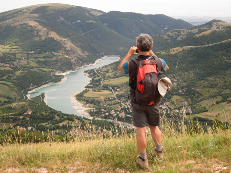
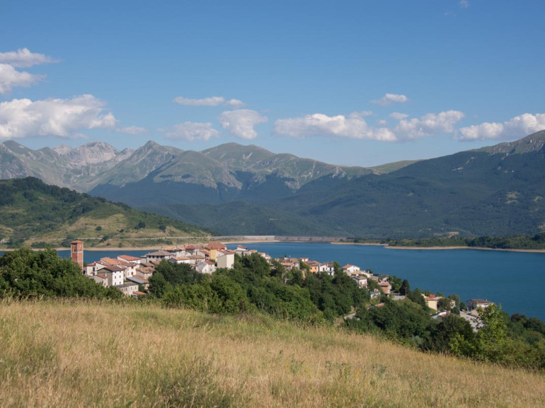
Third day: leaving from Camerino for a whole route stage among the Monti Sibillini National Park. Paved and unpaved routes twist and turn on almost 23km, requiring almost 7 hours with a difference in altitude of 1000m. Fiastra and its gorgeous lake will pay you back for every effort!
Do not miss: the romanic church of Saint Paul, Malagotti Castle and Fiastra Lake
4. Fiastra - Ussita
The fourth stage of this itinerary awaits you with endless enchanting glimpses. Other 23km in 7 hours walking towards Ussita and its valley, along the crest of the Sibillini Mountains. Meadows, local flora and fauna awaits you.
Do not miss: Macereto Sanctuary
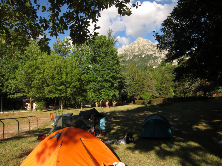
5. Ussita - Campi di Norcia
19km and 6 hours and a half in the hearth of the Alta Valle of the Nera River. The fifth stage will lead you side by side with Mareschio, Cardosa and Macchialunga Mountain, on an ancient route leading to Norcia.
Do not miss: the historical village of Visso
6. Campi di Norcia - Norcia
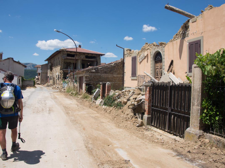
A very short stage this one, with only 9 km and 3 hours to walk. On the 6th day you can discover the beautiful Castoriana Valley and the Santa Scolastica upland, that will lead us to the charming Norcia, still strongly affected by the consequences of the hearthquakes.
Do not miss: Piè del Colle, Sant'Angelo and Norcia itself.
7. Norcia - Castelluccio di Norcia
The seventh stage will show you the wonders of the Castelluccio di Norcia uplands. In fact, after climbing up to Mount Ventosola, you'll catch unforgettable glimpses on the surrounding peaks. Final destination is Castelluccio, after 15,4 km and 5 hours of excursion.
Do not miss: the BIO and PGI lentil field
8. Castelluccio di Norcia - Arquata del Tronto
The eight stage is 19 km long mostly on a descending path and with 5 hours walking. Along the route you can still see the traces of the hearthquake, as in the villages of Pretare and Piedilama, but summer in these areas is always full with bright vivid colours.
Do not miss: the greenlands of the Umbrian valleys
Looking for a green accommodation? Colle le Cese Farmhouse and Centro dei Due Parchi Country House are ready for you.
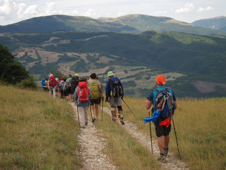
9. Arquata del Tronto - Accumoli
The ninth day leads us from the Monti Sibillini National Park to the one of the Gran Sasso, the highest mountain of the Appennines. First on paved road, then among the magical woods, this is an intense 17 km long stage, to discover the stories of the villages challenged the most by the hearthquake.
Do not miss: the Gran Sasso National Park and the Monti della Laga
10. Accumoli - Amatrice
Waling towards Amatrice city center, destroyed by the hearthquake in 2016. We've reached the region Lazio by now, along other 17 km and 5 hours of walking.
N.B. To complete this stage during these months (July-August 2018) you need the Municipality's authorization.
Do not miss: the stories of the villages to be crossed along the way.
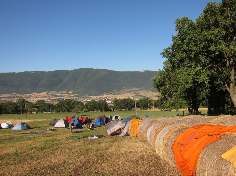
11. Amatrice - Campotosto
Along today's track we'll be walking for 11 km in around 5 hours, to reach Campotosto. Located among the Cime della Laga, Mount Cardito and the beauties of the Appennines.
Do not miss: Mount Cardito's Lake and the local flora and fauna in the Appennines.
12. Campotosto - Mascioni
Our twelfth stage starts from Mount Cardito once again: embark yourself on a 14 km long route towards Mount Coculle's peak, where NO tracks to follow are present, but where you have to find your own way among the brooms. Once you've reached Mount Mascioni, you can admire the majestic Gran Sasso.
Do not miss: Poggio Cancelli, the glimpses from Mount Mascioni
13. Mascioni - Collebrincioni
This is quite a hard stage: you step from the gentle greenlands to the granite rocks of the Gran Sasso. 25 km and 7.5 hours of walking are waiting for you!
Do not miss: the uplands just before Collebrincioni
14. Collebrincioni - L'Aquila
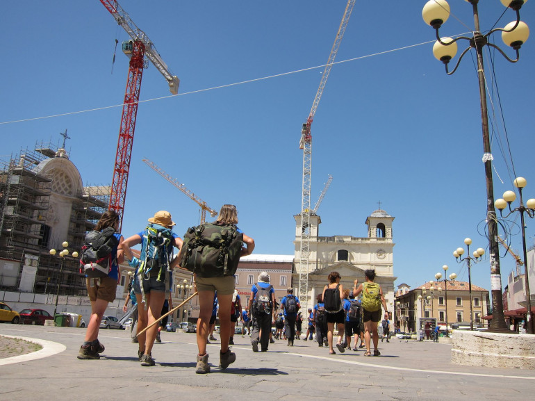
This is the very final stage: it only takes us 9 km to get to our destination: L'Aquila. Enjoy all the natural beauties you'll find on your way to Abruzzo's most important city. Once you get to the city center, explore every corner and its history!
Do not miss: the Fonte Vecchia and the Madonna Fore Sanctuary.
To conclude this beautiful journey, Garibaldi Apartments awaits you.