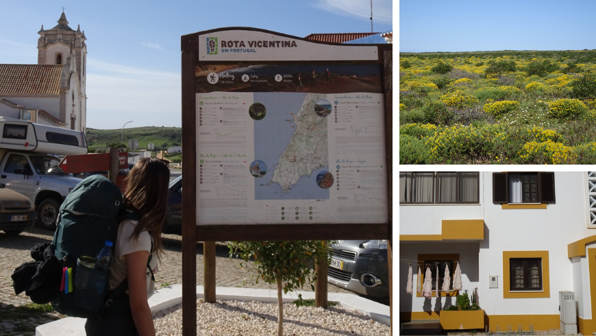
Nestled within its diverse landscapes, vibrant cities, and rich culture, Portugal invites exploration. The Fishermen’s Trail is a great choice for those interested in outdoor activities. If you enjoy going on multi-day hiking trips read on for more information about this trail!
Portugal has one of Europe’s most captivating coastlines, stretching over 1,800 kilometres. The Fishermen’s Trail, or “Trilho dos Pescadores” in Portuguese, is a segment of the larger Rota Vicentina trail network. It goes along the Alentejo coastline, all the way down to the southwestern edge of the country. It includes a total of 13 steps starting from Porto Covo and ending in Lagos, being a total of 226.5 km.
By concluding this itinerary, hikers can get to know more about Portugal’s maritime heritage, traditional fishing villages, untouched beaches, and breathtaking cliffs. Moreover, it’s possible to do it by bike as well; the whole trail is very well-organized and signed. The hike itself is moderate, walking each day around 20 kilometers along the ocean. I’d like to share my experiences through the last few stops of the trail, from Vila do Bispo to Lagos.
From Vila do Bispo to Sagres
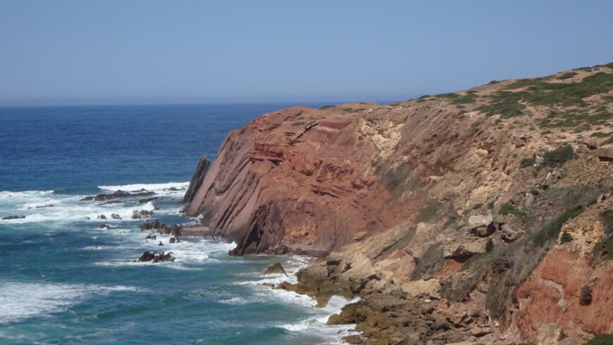
As we got to the town of Vila do Bispo, we quickly found the first sign and from then on it was impossible to get lost. We got out of the inhabited area and made our way to the coastal dirt road all the way to the Cabo de São Vicente. It’s impossible not to fall in love already with the landscape. This part is unique; in fact, it was classified as Sagres Biogenetic Reserve in 1988. Hikers can find endemic species that only occur in this region and along the southwest coast of Portugal.
Arriving at Cabo de São Vicente means standing in the southwesternmost point of Europe. The dramatic cliffs and expansive views over the Atlantic Ocean make this a breathtaking stop. There is a lighthouse, a café, and also a few vendors. As we approached the cape, we were captivated by the power of the waves crashing against the towering cliffs.
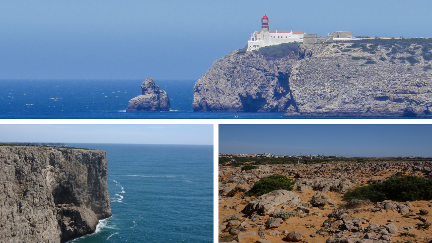
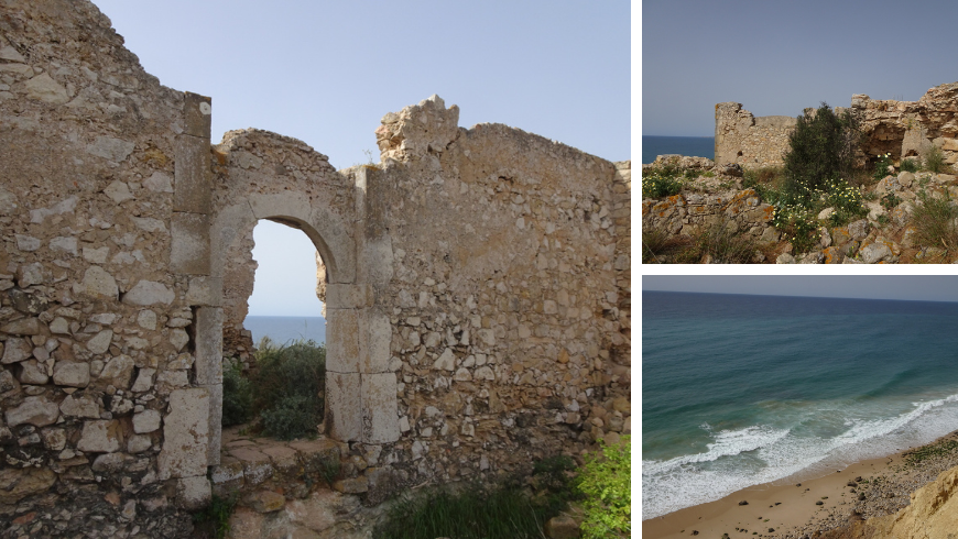
The road continues on the high coast towards Sagres. The name itself translates to “sacred”. It was for three millennia one of the limits of the known world within the extreme southwest of Europe. Before arriving at the center, there is the Sagres Fortress from the 17th century that once guarded the town.
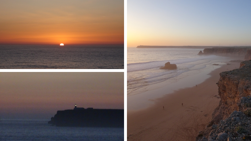
Without a doubt I recommend coming back here after dinner to watch the sunset. The view of the lighthouse in the far and of the beach under us is breathtaking. The town itself is a hub for surf enthusiasts; there are several bars and shops where they gather. It gives a really good vibe to the city.
From Sagres to Salema
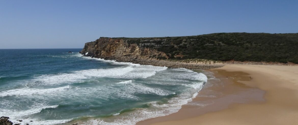
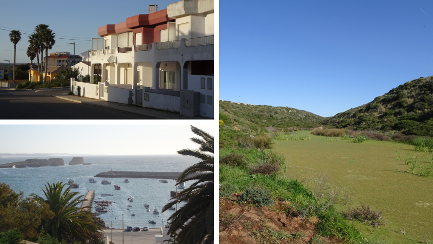
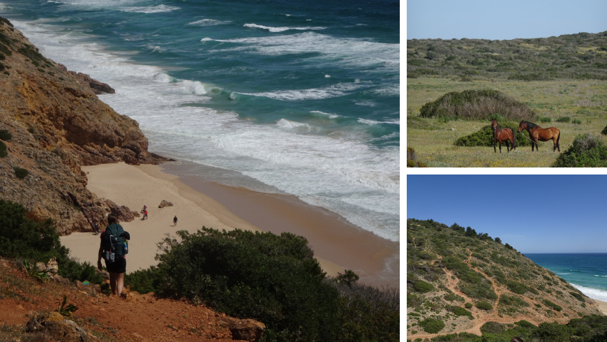
After getting some breakfast in the southwesternmost shop in Europe, we started our day by crossing Sagres. It’s possible to see its port from above and then the trail goes onward. During this piece between Sagres and Salema, the trail continues on the high coast and sometimes ascends to secluded beaches with stunning rock formations. Praia dos Rebolinhos with the Martinhal Lagoon is interesting, as there is a small lake there. It’s dry in the summer, but during the winter, it’s filled with saltwater and gives a home to many species.
Moving on, before arriving in the town of Salema, there are 7 more beaches to pass. The challenge of this trail is to always climb up and then down to the high coast between these beaches. The trail passes next to an abandoned building and we met two horses as well along the way.
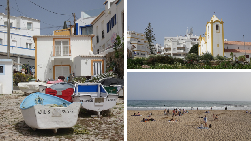
Salema is a welcoming fishing town with many apartments to rent; it’s a popular vacation destination for foreigners. There are many restaurants to choose from as well, but unfortunately, they are all on the pricier side.
From Salema to Luz
The next day was the shortest one walking from Salema to Luz. After parting, there is a great view of the town from above. The next beach is called Praia da Boca do Rio. An interesting fact is that less than 2 kilometers from there, at the bottom of the ocean, are the remains of L’Océan, a 60-meter-long ship. It was the admiral ship of a French fleet and during the Seven Years War. The British navy sunk it in the Battle of Lagos in August 1759. Right after the beach is the Forte de Almádena, a former lookout fort on a hidden cliff overlooking the Atlantic. It was abandoned when the coast was no longer under threat after pirate attacks during the 17th century.
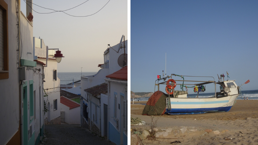
Then the road continues onward on the high coast until Burgau. It’s a charming town with its white houses and narrow streets. We continued to the center of Luz, a town with white sand beach, where we dipped into the 16-degree ocean.
From Luz to Lagos
The last day of this coastal trail is quite easy. Hikers just have to reach Lagos and enjoy the beautiful views of rock formations. Our day started by climbing up to the Atalaia geodetic point. It’s 108 meters above sea level being the highest point of the Algarve coastline. The view is gorgeous from here and also from the Rocha Negra rock formation, which is just a few passes away.
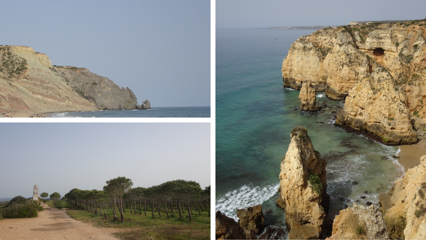
The cliffs between Luz Beach and Ponta da Piedade reveal interesting details about Earth’s history in the Middle Cretaceous period, just before dinosaurs faced extinction. The landscape, with white limestone and black volcanic rocks, shows organized patterns and unique shapes shaped by erosion. West of Luz Beach, Ponta da Calheta has sandstone layers with ancient snail fossils. In fact, it indicates coastal features over 100 million years ago. Moving on to Praia de Porto Mós on the high coast, the view of the many surfers in the ocean is very inviting.
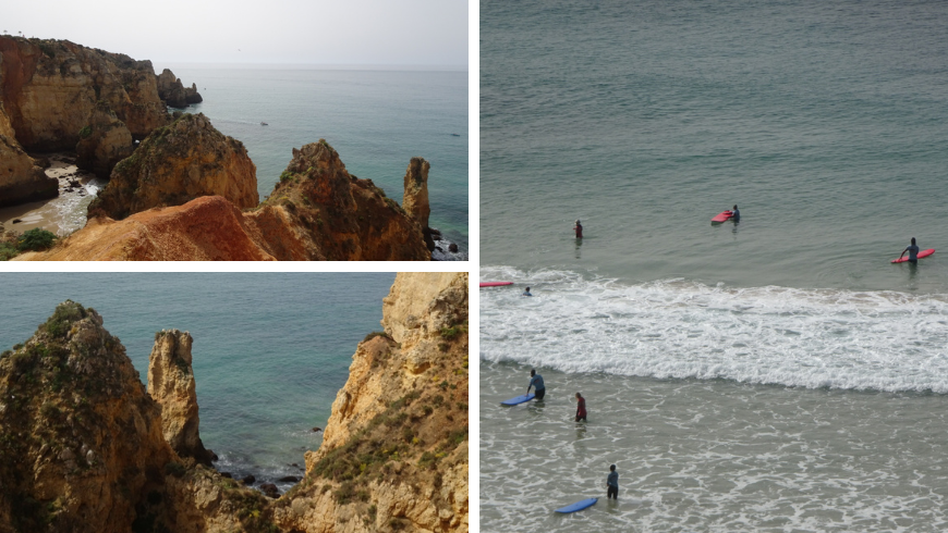
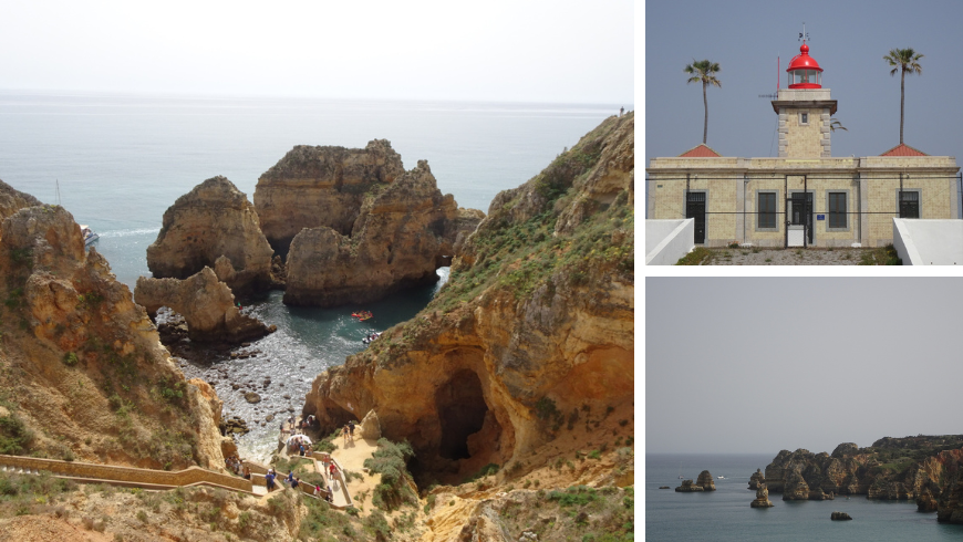
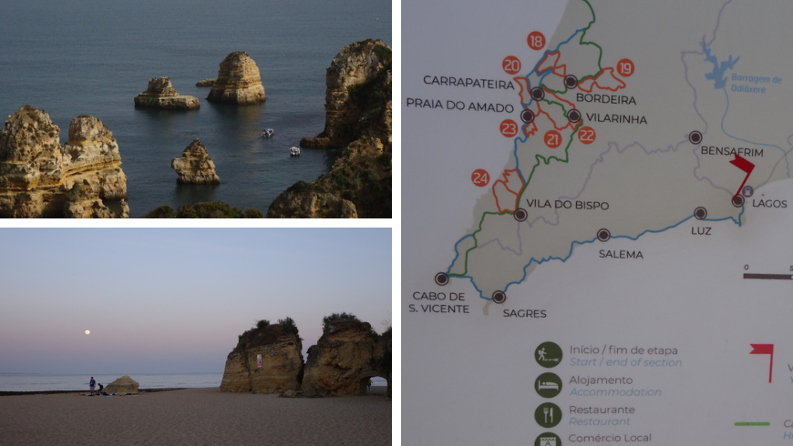
Finally, we arrive at Ponta da Piedade, which is the reward for completing the trail. It has impressive rock formations like arches, rocks emerging from the water, and caves. It’s possible to ascend to the caves on a long staircase, where they offer short boat tours to see the formations from the water. This rocky area once housed a Roman temple, a Moorish temple, a Christian hermitage, a fortification for protecting Torrinha’s fishing gear, and even a lighthouse. Arriving in Lagos marks the end of our journey but the start of the famous Algarve region. The city is lively, being a popular summer destination for its sun, beaches, and cultural heritage as well.
In conclusion, the Fishermen’s Trail along the stunning coastline is a must in Portugal. It’s not just a physical journey through breathtaking landscapes but a profound exploration of the region’s geological, historical, and cultural tapestry. The trail is very well organized; there is all the information one would need on the official website of the Rota Vicentina.
Photos by Viktoria Szabo


