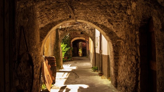
Beyond Cinque Terre, Liguria offers a lot of breathtaking itineraries for free… come and discover the 5 most beautiful paths in the region with us!
Cinque Terre is one of Italy’s most idyllic seaside cluster of villages. The place is famous all over the world for its timeless beauty. However, overtourism is now a serious problem. The prices have shot up in the last few years and it is extremely difficult to find a period in which it is possible to fully enjoy this enchanting place.
Beyond the popular Cinque Terre, Liguria offers less known, but equally splendid trails overhanging the sea. They are perfect for an authentic experience in harmony with nature. Let’s discover together 5 free and incredibly beautiful itineraries, ideal for trekking lovers as an alternative to the famous Cinque Terre:
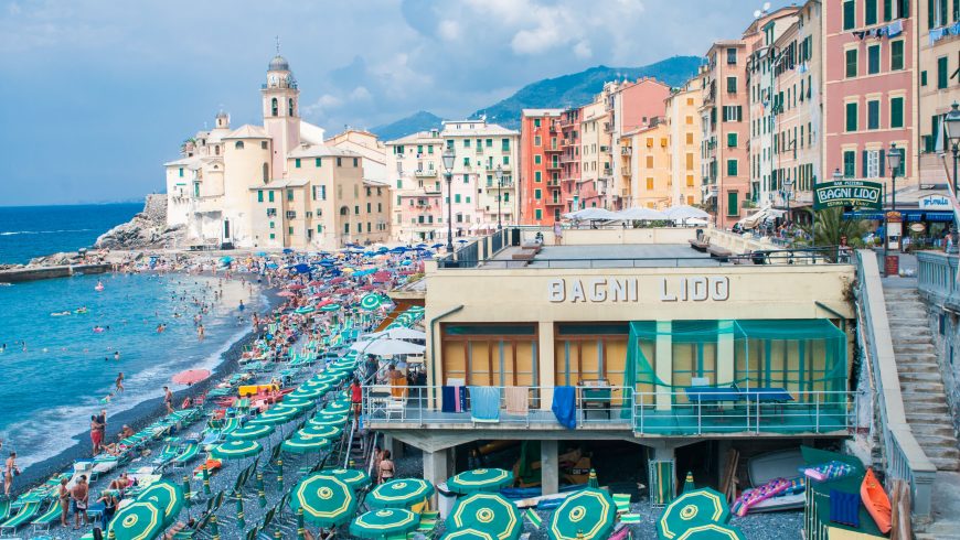
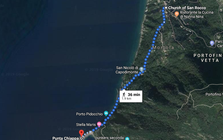
1. From San Rocco di Camogli to Punta Chiappa
It is a pleasant and easy path, lasting about 30 minutes and almost 2 km long. Right after the square of the church of San Rocco, take via Mortola, the beautiful promenade close to the sea. Here you will find the Bar Dai Muagetti, a lovely place where you can enjoy an aperitif overlooking the gulf of Genoa. After about 200 meters, turn right and go down a suggestive staircase.
Shortly after a shaded path surrounded by some houses, you will get to the small square of the medieval church San Nicolò Capodimonte. The view from this point is absolutely breathtaking. From here there are two possible solutions to reach the sea: continue along the easy and short staircase that reaches Punta Chiappa through the picturesque village of Porto Pidocchio or go along the small road on the left of the church.
To live an authentic experience surrounded by nature, we advise you to choose the latter path. The wild and somewhat uneven trail winds under the pines and offers suggestive panoramic views of the gulf. Punta Chiappa, the small strip of rock that juts out into the sea, is at the end of this trail. It is a little corner of paradise, with huge rocks overlooking the sea and crystal-clear water. Fishing is a very popular activity in this place and it is enhanced by local restaurants.
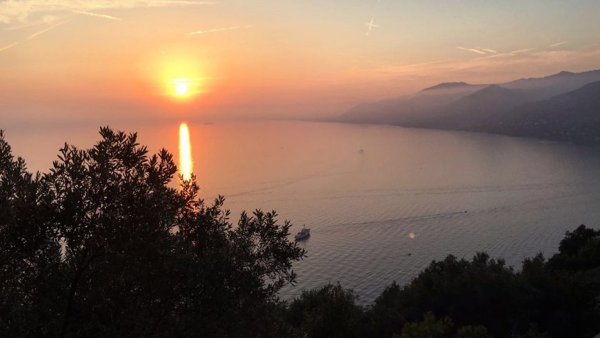
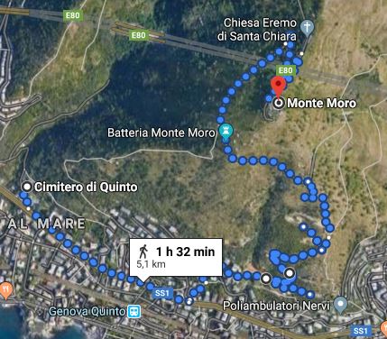
2. Monte Moro and its coastal battery (Genova Nervi)
Monte Moro, above Quinto al Mare, is the ideal place for a walk between history and nature. In fact, the coastal battery of Monte Moro was one of the main defensive complexes protecting the gulf of Genoa. You can choose the duration of the itinerary, but it is advisable to dedicate at least half a day to it, given the extension of the works and the beautiful landscapes. You can park your vehicle at the Quinto Cemetery, just a few steps from the highway exit of Genova Nervi.
From there you can walk the Vecchia Strada Militare, which is the path that leads directly to the mountain. Then, you will reach one of the first signs of the fortified complex. Along the way, you will have the opportunity to closely observe bunkers, sentry boxes and crumbling antiaircraft positions, dating back to the Second World War.
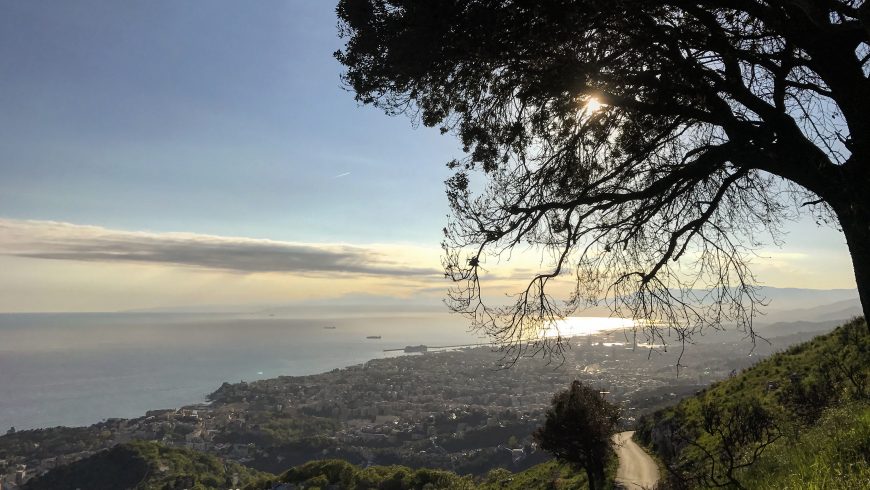
The sea view makes the trail even more enchanting. You won’t be able to stop yourself taking several photos and being surprised at every corner.
Thanks to the geomorphological conformation of the city and the particularity of its urban development, the fortified complex of Monte Moro is still preserved. However, there is a total indifference towards the area, which is left to itself. Moreover, it is defaced from an environmental point of view.
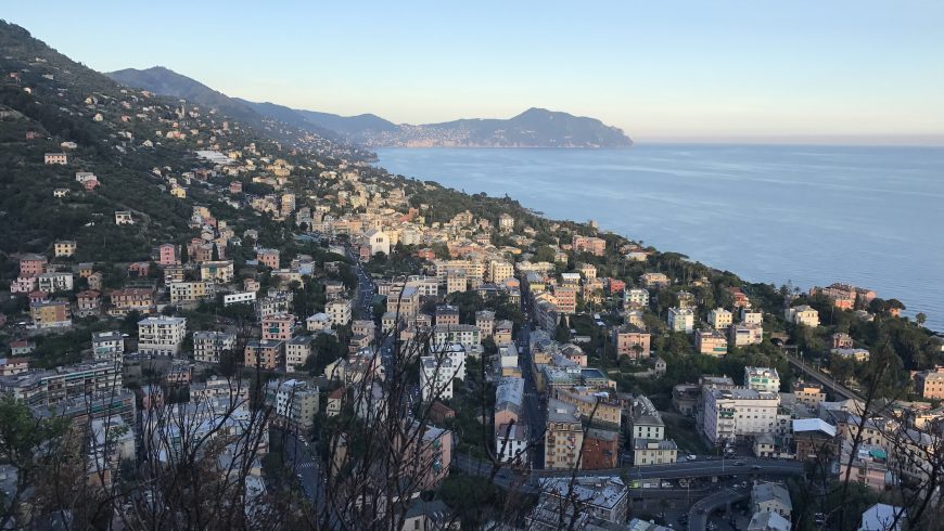
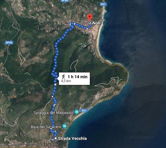
3. From Varigotti to Noli
The trail from Varigotti to Noli, or Sentiero del Pellegrino, is an incredible excursion in the Western Ligurian Riviera. The hike lasts about 3 hours and it is of medium difficulty.
It starts from Via Strada Vecchia, where the initial uphill sections are rather demanding. Soon, a breathtaking view of the surrounding landscapes will reward your effort.
Continuing the climb, you will reach Punta Crena. From there, the panorama sweeps from the Eastern to the Western Riviera. A paved stretch leads up to the climb to Monte di Capo Noli. Continuing along with a flight of steps, the landscape turns into a succession of fragrant olive groves.
From the top of the mountain, you have to descend towards Noli, passing through caves and caverns. Among these, there is the Grotta dei Briganti, the headquarters of the smugglers who kept their goods there in past times.
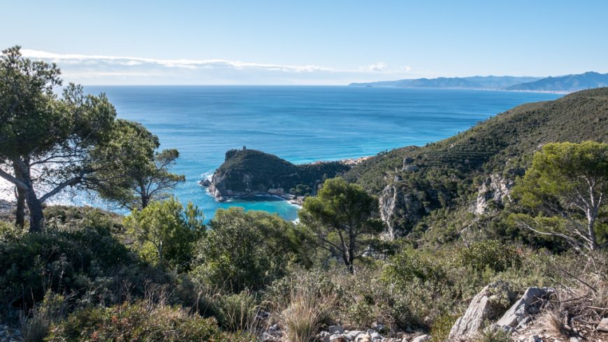
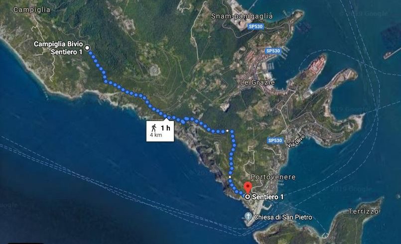
4. From Campiglia to Portovenere
The stretch from Campiglia to Portovenere, in the Eastern Liguria, is easily walkable and offers breathtaking views. Despite the proximity to the Cinque Terre, this path is still far from mass tourism and is suitable for those who want an undemanding day of trekking.
The beginning of the trail is Campiglia, a small hamlet 20 minutes by car from La Spezia. At the last hairpin before the town, some paths branch off to Riomaggiore or Portovenere. The itinerary begins from here, along path 1 CAI.
The trail is mainly flat and downhill and it follows the whole ridge of the mountain overlooking the sea. The glimpses of the Cinque Terre, of the profile of Portovenere, and of Isola Palmaria are spectacular. They appear and disappear among the Mediterranean scrub formed by myrtle, strawberry trees, and capers.
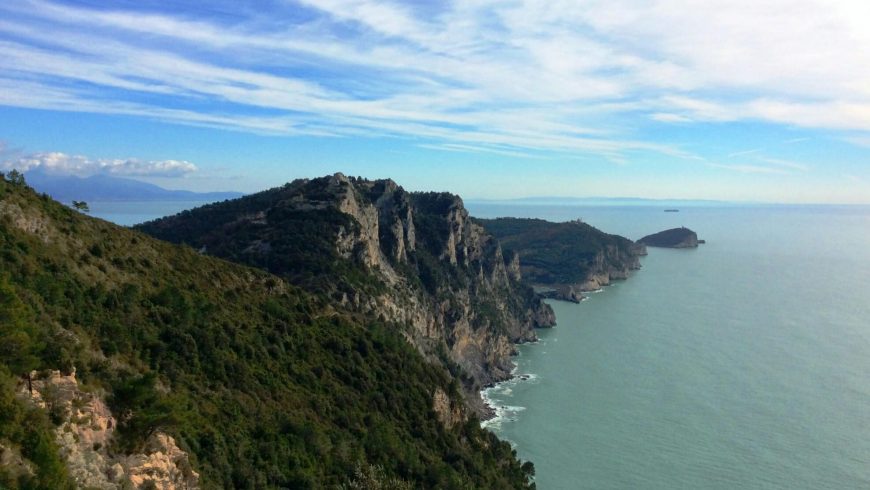
The hiking route is not particularly demanding, but in some places, you need to be careful: the surface overlooking the sea, consisting mainly of stones, is uneven and not entirely safe.
About halfway along the trail, you reach Rifugio Muzzerone, whose name comes from the nearby Forte Muzzerone, unfortunately, close to the public. The descent towards Portovenere leads you to the suggesting church of San Pietro, built on the rocky promontory overlooking the cliffs.
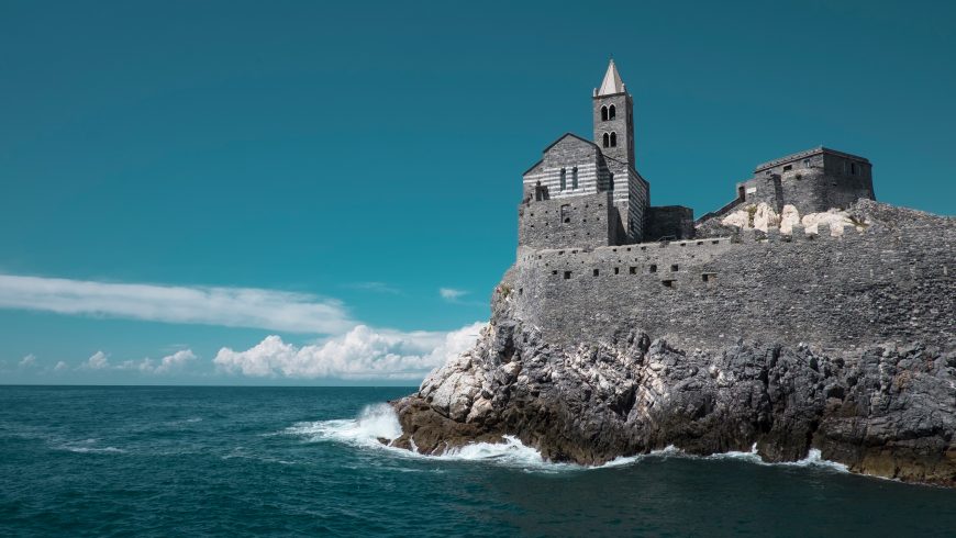
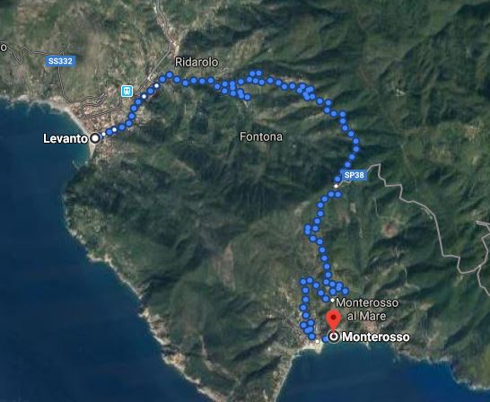
5. From Levanto to Monterosso
The last hike we recommend is nor far from the Cinque Terre, but it is free and not so crowded. We are talking about the trail from Levanto to Monterosso.
It lasts about 2 and a half hours. The route is easy and suitable for everyone, even for families with children.
Getting to the beginning of the trail is easy: from the waterfront, you just have to go east to the castle, until you reach the portico of a villa with blue stores. From here, take a ladder-climbing beside the castle and the ancient city walls. At this point, take the cobbled road that rises slightly uphill to the woods. It is here that the trail begins.
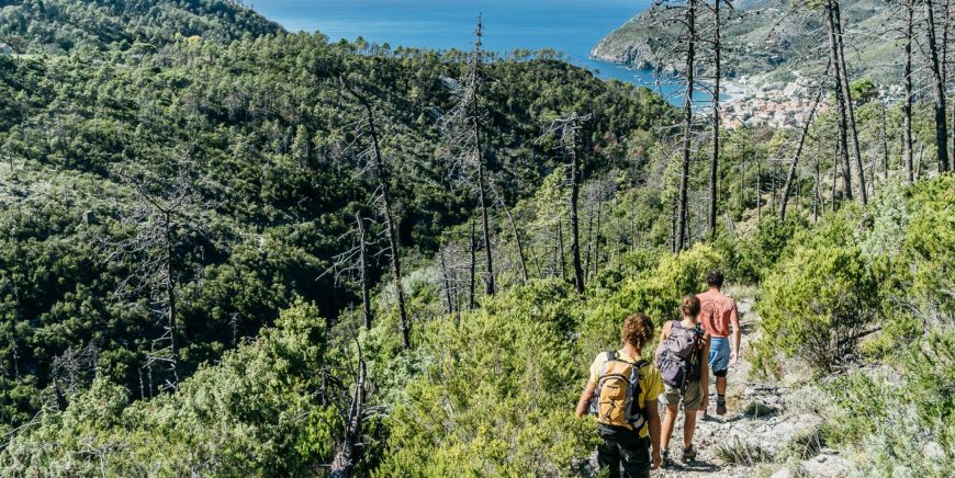
Along the way, you can enjoy breathtaking views of the sea, between sea pines and broom. In spring, the vegetation is lush and wild, with different scents and colors at every corner.
Shortly after Punta Mesco begins the descent that reaches first the village of Fegina and then the historic center of Monterosso.
Cover image: Photo by Suborna Jahan on Unsplash
