The Azores offer you beautiful hiking trails amidst lakes, hills, cliffs, and lush forests. It is a great hiking destination. The weather is unpredictable, choose the best day to hike and go on an adventure!
1. Hiking Mount Pico, Pico Island

This is a high difficulty trail of 11.2 km. It is the highest mountain in the Azores, as well as Portugal. It stands 2,351 meters above the sea. Firstly, it takes around 2.5 hours to get to the moon-like crater navigating through different types of lava rocks. Therefore, you need another 30 minutes to climb the steeper Piquinho. Here is where the panoramic view of nearby Sao Jorge and Faial Island awaits you.
2. Hiking Monte Brasil, Terceira Island

This trail of medium difficulty of 7.5 km offers you several panoramic views of unspoiled nature and unique landscape. You will walk surrounded by the Bay of Angra and the Bay of Fanal. It is a circular hiking trail that starts and ends at Relvao Park. Start climbing nearby the St. John the Baptist’s fortress. After following the trail signs, you will reach the Santo Antonio chapel. Enjoy the Pico do Facho viewpoint, Vigia da Baleia viewpoint and Pico das Cruzinhas viewpoint. Finally, look over the city Angra do Heroismo.
3. Hiking Caldeirão, Corvo Island

We arrive on Corvo island where we find a medium difficulty trail of 4.8 km. Silence and birdwatching are the keynotes. The circular hiking trail of Caldeirao goes around a collapsed crater. You will enjoy the sense of isolation in this place. The hiking trail starts at Caldeirão viewpoint. Pass by the lagoons and you will reach a large mushrooms field. Keep walking until Poço da Velha. Once arrived on the top, climb the same path that you descended, until you return to the starting point.
4. Hiking Caldeira de Santo Cristo, São Jorge Island

This is a medium difficulty trail of 10 km. The linear hiking trail to Caldeira de Santo Cristo starts from Serra do Topo, next to the car parking. Then, climb a wide trail, until you reach a water tank. There you have the possibility to visit a waterfall 3 km apart. Continue on the cobbled path towards Fajã da Caldeira de Santo Cristo. Follow the trail to Fajã dos Cubres, where you can enjoy the lagoon and migratory birds.
5. Hiking Salto do Cabrito, São Miguel Island

For the ones more inexperienced, the island of São Miguel offers a low difficulty trail of 7.5 km. It is not far from Salto do Cabrito waterfall. This circular walking trail starts and ends in the area of Caldeiras of Ribeira Grande. It is a well-known spot for its hot springs. Take the road towards Lombadas and Monte Escuro. Hop the chain fence to get access to Fajã do Redondo dam. Then, enjoy a walk surrounded by waters of Ribeira Grande. The forest track will be full of eucalyptus, acacia, and Japanese red cedar. You will pass by Faja do Redondo electricity museum. In the end, climb the stairs until you reach the Salto do Cabrito wonderful waterfall.
6. Hiking Caldeira-Faial, Faial Island

This is a low difficulty trail of 7 km. It is the most famous attraction on Faial island. It is located right in the middle of the island. This is the largest crater of 400 m in depth and 2 km in diameter. This circular hiking trail is fairly easy. You start the trail at the Caldeira viewpoint and you cross the small access tunnel to the crater. Enjoy the view over the North and West coast and its flourishing flora (Azorean juniper, heather, blueberry, Euphorbia and Angelica). Finally, climb until Cabeço Gordo, the highest point of the trail of 1,043 m.
7. Hiking Fajã Grande, Flores Island

For the more experienced hikers, the island of Flores has a trail of a high difficulty of 13 km. It starts nearby Fajã Grande. Firstly, you have to take the road to Ponte da Fajã. Secondly, walk along the cliff. Then, take a steep climb to Rocha do Risco. Once arrived there, continue on the coastal path where there are Azores heathers and hydrangeas. On this trail, you will walk along lagoons, sea cliffs, laurisilva forests, different viewpoints and natural swimming pools and waterfalls.
8. Hiking Sete Cidades Lake, São Miguel Island

Another easy trail of 11.8 km. The hiking trail starts nearby the Canario Woods. Here, go down until you reach the “Nice Windows Wall”. In addition, follow the trail until you reach the viewpoint of Pico da Cruz. Pass by the crater’s edge of the blue Lagoa Azul ending up in the town of Sete Cidades.
9. Hiking Passagem das Bestas, Terceira Island

Passagem das Bestas is a medium difficulty trail of 4km. This circular hiking trail is located in the protected area of Caldeira de Guilherme Moniz, by the Macaronesian forests. Firstly, start from Porto Judeu. Then, go down the old rocky lava field until you arrive at the mini-hydric power plants of Angra. Here, you can admire the largest crater in the Azores. The view is between the Ribeirinha mountain range and the Serra do Cume mountain. You will pass by the Terra Brava viewpoint.
10. Hiking to Lagoa do Fogo, São Miguel Island

Lagoa do Fogo is a medium difficulty trail of 12 km. The Lagoa do Fogo is a crater lake at the centre of Sao Miguel Island. The hiking trail to this lake has four main parts. This Sao Miguel Island hiking trail begins from Praia. Furthermore, go through the narrow roads of the farmland with plenty of goats to view. Then, you will enter the forest lining the path until you arrive at a Levada, irrigation channel. There, you can explore several endemic florae, like Blueberry, the Azorean Heather, and the Laurustinus with stunning views of the Atlantic Ocean. Passing by the valley of Ribeira da Praia, you will finally arrive at the bottom where the chirping seagulls will greet you.

Bring your hiking equipment, and choose a day with good weather. Respect nature during the hike and choose the best trail with stunning views. Each island in the Azores has a unique character and cultural identity.
What is the best hike for you?
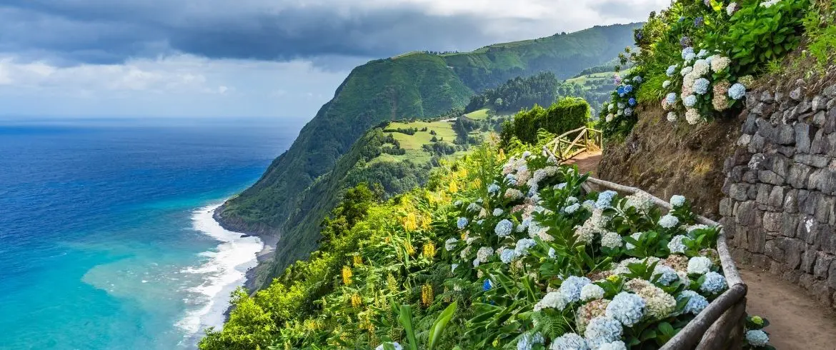
Cover image: Sao Miguel Island walking tour, Azores, Portugal, photo via Canva Pro


