
In Trentino, along the border with Lombardy, a vast protected area, where the uncontaminated nature reigns, awaits you. It’s the Adamello Brenta Natural Park. Here you can experience unique emotions among wild landscapes, breathtaking waterfalls, mountains that are a UNESCO World Heritage Site, endless forests and multicolored lakes. In the park there are plenty of trails, which allow you to explore the valleys, climb to the top of the Dolomites and reach the mountain huts to taste traditional dishes.
We found 5 beautiful routes to do on foot, by bike and with the Park’s shuttle buses: ready to discover incredible places?
1. The waterfall path in Val Genova

It starts from the municipality of Carisolo in Val Rendena and then goes west. After 9 kilometers we reach Ponte Maria: we are at an altitude of 1170 m, in the heart of the Adamello-Presanella group. From here we take a shuttle bus that takes us to the Malga Bédole. In front of us, a landscape that is difficult to describe, which cannot leave us indifferent: a vast pasture between the mountains, so beautiful and imposing, the silence of nature broken by the roar of the Sarca stream that descends from the Adamello glaciers to Lake Garda. Now we are ready for 3 kilometers of trekking, during which we will be able to discover the glacier that was there and the life of plants and animals that took over. We pass the Bédole refuge, the Bridge of Cambiali, the Bivouac of the Pioneers until we reach Mandar Mataròt, at an altitude of 1800 m. From here you return to Malga Bédole, then take the Waterfall Path along the forest road, following a wooden bridge over the Sarca. The path descends along the orographic right, through the plains and the glacial steps. Up to Ponte Maria we can admire the Cèrcen, Pedrùc, Gabbiolo, Stablèl, Casina Muta, Folgorìda and Làres waterfalls.

2. Pian della Nana and Mount Peller

© Andrea Inzani via Wikimedia
It is hard to imagine that there were once dinosaurs and warm seas in Trentino. Pian della Nana helps us do this. From the municipality of Cles in Val di Non we reach the parking lot of the Malga Tassulla, at 1885m. Here begins a circular itinerary, which immediately makes us discover a large prairie that is characterized by an atypical landscape, with sweet and undulating features. We set off towards the Malga at 2090 meters, admiring the islands of Rosso Ammonitico, rich in fossils of spiraling ammonites that populated the open seas of the Jurassic and Cretaceous Era. Once you reach the Forcola Pass, go down to the small Lake of Salare and then continue around Mount Peller, heading north, through suggestive conifer woods. We reach the Peller Refuge and then conclude the ring route.

3. Algone Valley and the Movlina Plateau
We start from the municipality of Stenico proceeding westwards to the Lisàn bridge, from where we take Algone Valley. Here we follow the forest road that leads us to the quartz quarries, dating back to the 1950s. Among beech trees we reach the entrance of the path that goes up to Malga Movlina. Here we are in the heart of the park, on a panoramic plateau set among the glaciers of the Adamello Brenta Natural Park and its castles. Once our heart is full of beauty we follow the path 341 thanks to which we can make a circular route along the Val di Sacco and the imposing Vallon.

4. The Mjr Anton Malina path: the great war in the Adamello Brenta Natural Park
Not only nature: the Adamello Brenta Natural Park also preserves evidence of the Great War among trees and moss. The first trenches, small fortifications, loopholes facing the enemy, a machine-gun post: still there to remind us of the horrors of war. We follow in silence the path dedicated to the commander Anton Malina which starts near Fontanabona. Everywhere here and there are still pieces of stoves or covers, window panes, objects and tins of everyday use: it is a difficult story but that we must remember.
5. Brenta Dolomites by bike

There are two beautiful ring routes designed for those who want to experience the beauty of the Brenta Dolomites by bicycle. They are paths to be tackled in several days and that offer truly unique emotions. The two routes correspond to two levels, EXPERT that has 171 km and a total height of 7.700 m and COUNTRY of 134 km and 4800 m in altitude.
Find your eco-friendly Accommodation in the Adamello Brenta Natural Park
Coverphoto: Mandron lake and Lobbie, Val Genova, Adamello Brenta Natural Park, ph. by © Roberto Gervasoni
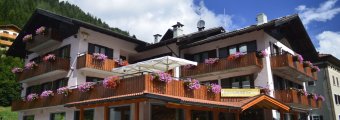 Hotel Regina Elena – Green Hotel in Caderzone, Trento, Trentino-Alto Adige, IT
 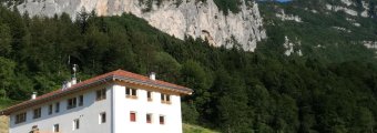 Agriturismo Biologico Maso Pertener – Green Farm house in Comano Terme, Trento, Trentino-Alto Adige, IT
  Alpen Suite Hotel - Campiglio – Green Hotel in MADONNA DI CAMPIGLIO, Provincia di Trento, Trentino, IT


